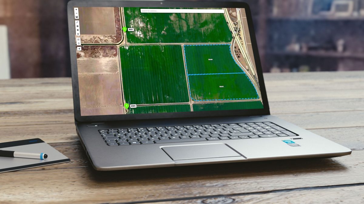
ATS has developed a very detailed mapping module in which field boundaries can be generated and edited for more accurate acreages and attributes. Field I.D.’s are saved and linked to the actual crop and County Agricultural Permit. ATS can automatically upload permit mapping polygons where and when available or they can be hand drawn inside the drawing editing area. You also have the option to upload any other geo-referenced file for instant field boundaries.
Trinitas Farming
Agri Tracking Systems brings real-time visibility and tracking to Trinitas Farming Agri Tracking Systems (ATS) provides integrated software to help growers plan, map, track, store, analyze, and report on every aspect of the farming operation. Trinitas farms over 20,000 acres of almonds and olives in...
Fine Grained Staff Permissions
ATS know your farm information is valuable and sensitive! This is why we developed a Fine-Grained staff permission feature of the program. ATS has the ability to allow access for certain individuals to access and input data in the system. For example, Irrigators may only...