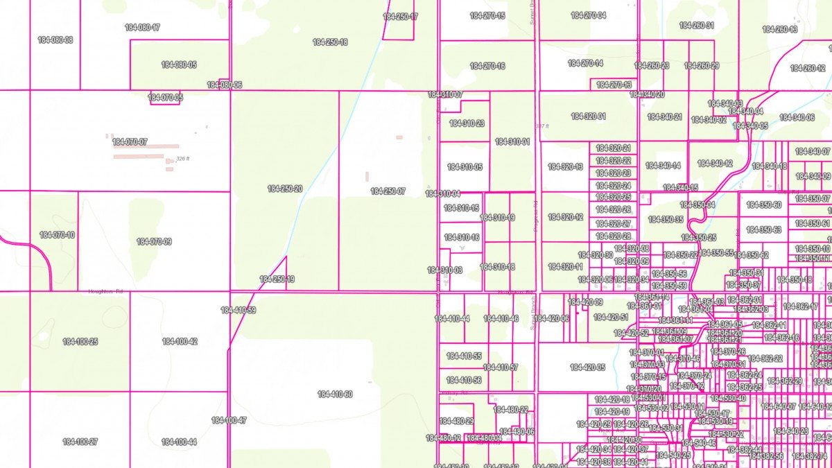
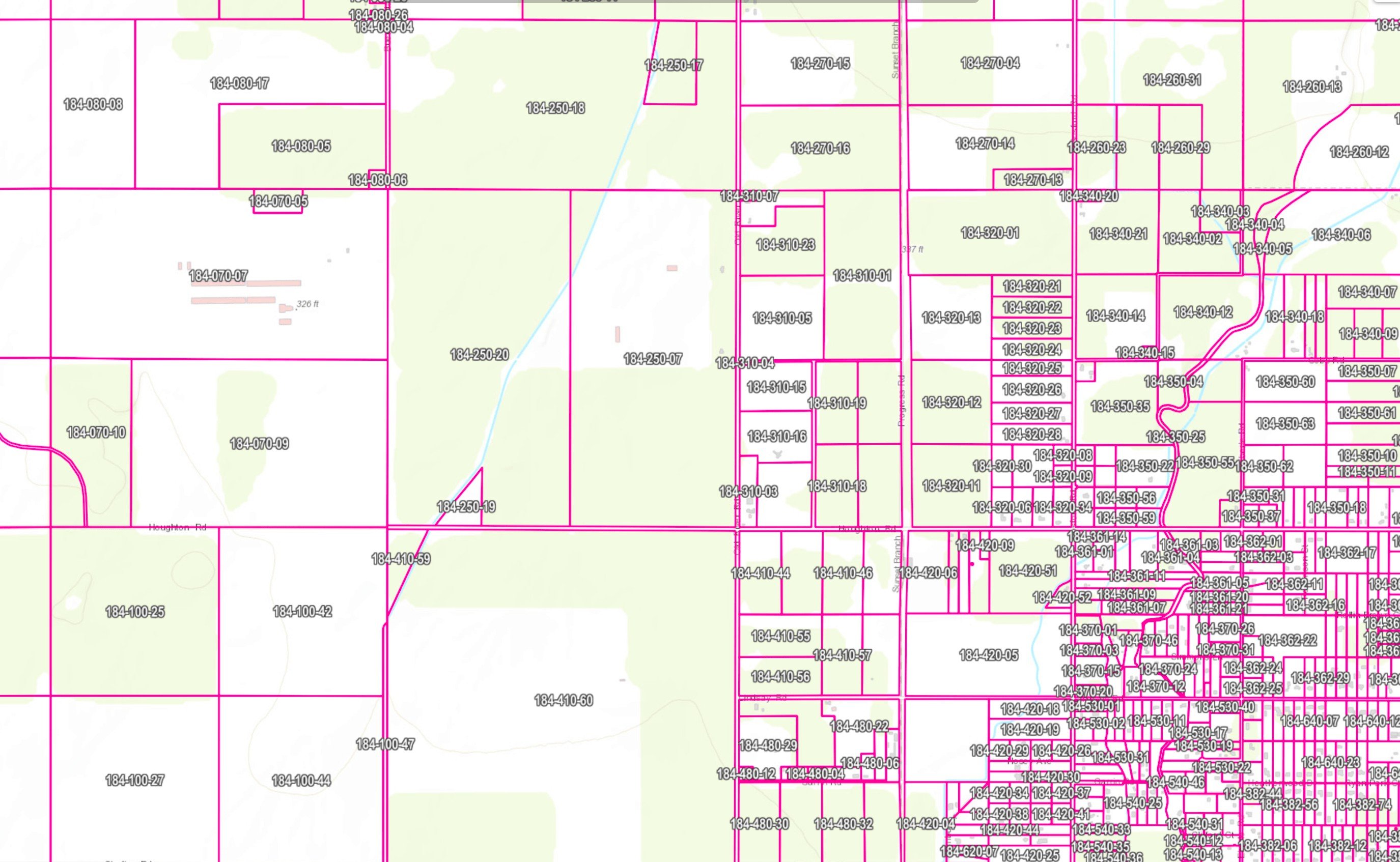
ATS has a complete Assessors Parcel Map (APN) overlay. This feature is widely used for any farming operation that is sending reports, filing Notice Of Intent (N.O.I.’s) into the water board or water coalitions. ATS has developed an algorithm that takes your field boundaries along with your APN’s and calculates the irrigated acreage for each APN inside the field ID even if there are multiple APN’s inside the field boundary OR multiple field ID’s inside one APN. This accurately allows you to show and report your farm information with crater boards and ILRP coalitions.
Trinitas Farming
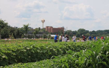
Agri Tracking Systems brings real-time visibility and tracking to Trinitas Farming Agri Tracking Systems (ATS) provides integrated software to help growers plan, map, track, store, analyze, and report on every aspect of the farming operation. Trinitas farms over 20,000 acres of almonds and olives in...
Fine Grained Staff Permissions
ATS know your farm information is valuable and sensitive! This is why we developed a Fine-Grained staff permission feature of the program. ATS has the ability to allow access for certain individuals to access and input data in the system. For example, Irrigators may only...