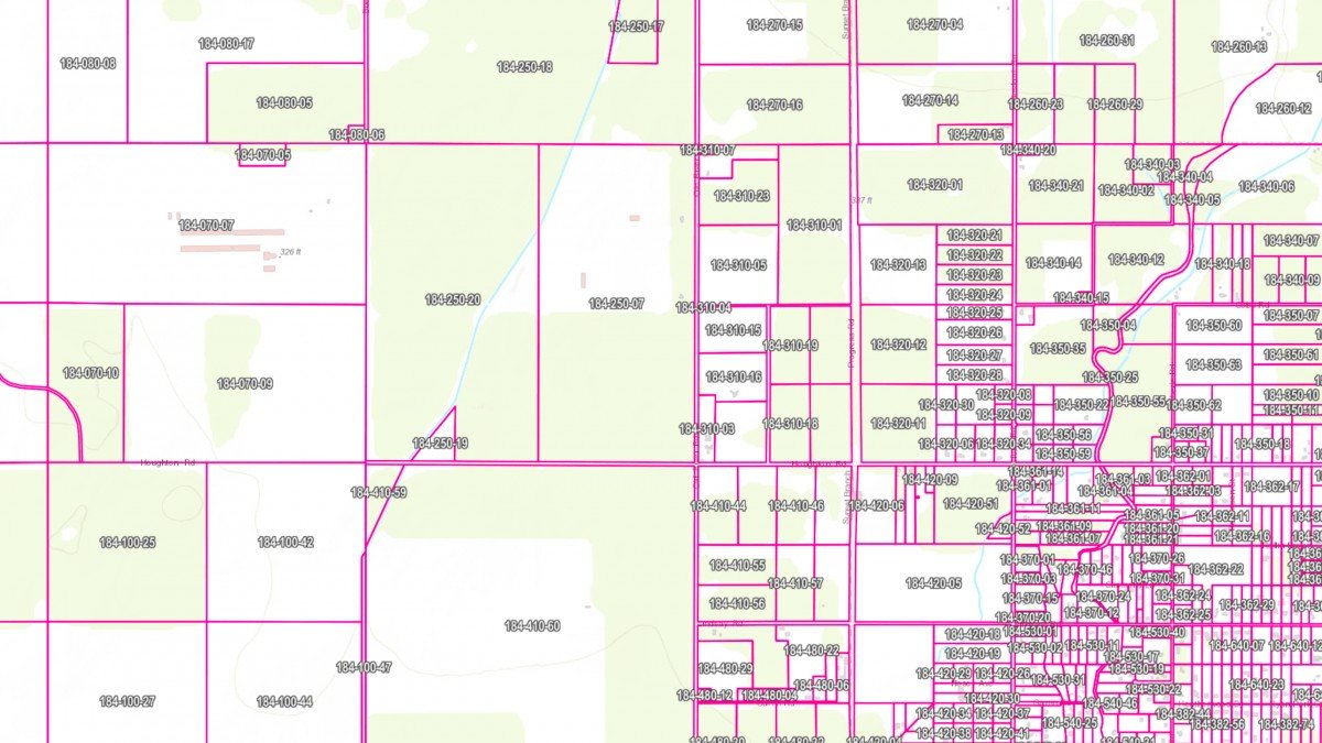
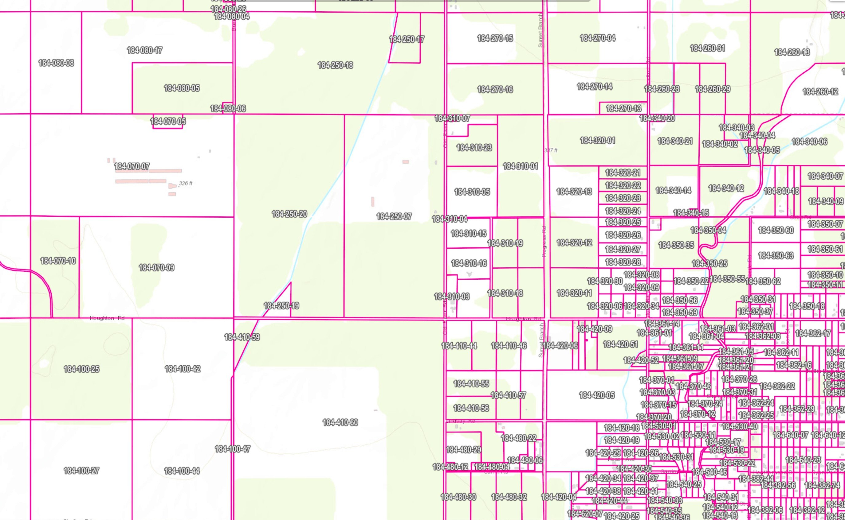
ATS has developed a unique process which allows you to overlay an up to date APN map over your Field boundary map while running a process that calculates your irrigated acres per APN per field. To our knowledge, no other program has this feature!
Trinitas Farming
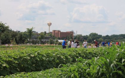
Agri Tracking Systems brings real-time visibility and tracking to Trinitas Farming Agri Tracking Systems (ATS) provides integrated software to help growers plan, map, track, store, analyze, and report on every aspect of the farming operation. Trinitas farms over 20,000 acres of almonds and olives in...
Fine Grained Staff Permissions
ATS know your farm information is valuable and sensitive! This is why we developed a Fine-Grained staff permission feature of the program. ATS has the ability to allow access for certain individuals to access and input data in the system. For example, Irrigators may only...