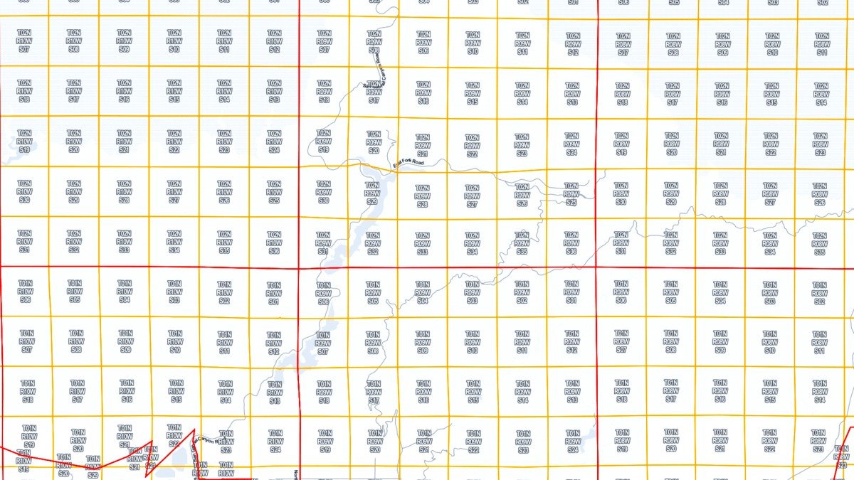
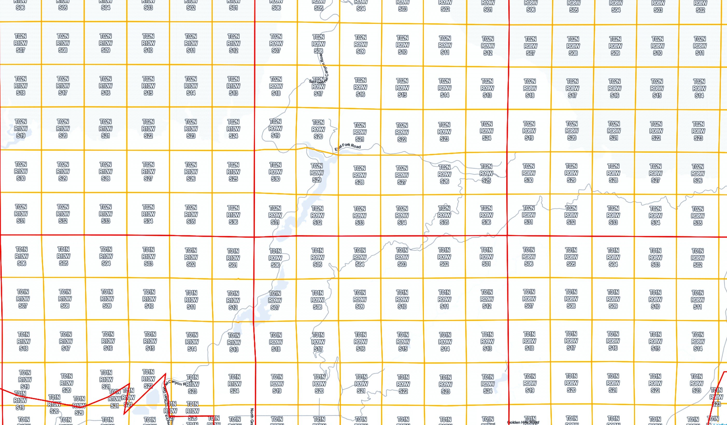
ATS has developed a Section township Range overlay inside its mapping module. This allows location finding and mapping used by county ag commissioner offices. These coordinates locations are also used by ILRP coalitions to submit application data to the water board.
Trinitas Farming
Agri Tracking Systems brings real-time visibility and tracking to Trinitas Farming Agri Tracking Systems (ATS) provides integrated software to help growers plan, map, track, store, analyze, and report on every aspect of the farming operation. Trinitas farms over 20,000 acres of almonds and olives in...
Fine Grained Staff Permissions
ATS know your farm information is valuable and sensitive! This is why we developed a Fine-Grained staff permission feature of the program. ATS has the ability to allow access for certain individuals to access and input data in the system. For example, Irrigators may only...