
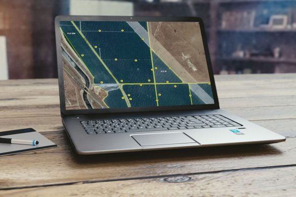
Driving Directions & GPS Location Tracking
ATS has developed a share/send location directly from its mapping module. With this feature, anyone can send a location of a marker, field boundary, field scouting location, or well location directly to anyone with a smart phone through a text. The receiver party simply opens...
Water District Boundary Maps
ATS was able to bring in and overlay Water District maps into the mapping module. This helps in identifying what water district you belong to when purchasing new properties or when you are managing multiple properties with multiple owners. Again, anyone in your team has...

Dairy Facility Mapping
ATS can zoom into and map the entire Dairy facility including pen numbers, well locations, lagoon, commodity barns, feed storage area, manure processing area, milking parlor and other map attributes that you might need to be mapped. This mapping feature has been used for posting...
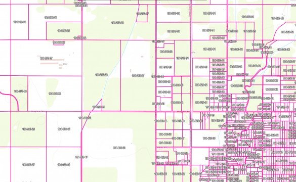
California APN Maps
ATS has a complete Assessors Parcel Map (APN) overlay. This feature is widely used for any farming operation that is sending reports, filing Notice Of Intent (N.O.I.’s) into the water board or water coalitions. ATS has developed an algorithm that takes your field boundaries along...
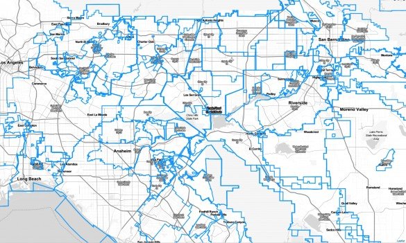
Irrigated Lands Coalition Boundary Maps
ATS has created an overlay inside its mapping module to show ILRP coalition boundaries. This allows you to know and prove which coalition your field belongs to. ATS has found a few APN’s that were originally thought to be in one coalition but actually in...
Irrigation Locations (Well, Canal Inlet, Reservoir, Filter Station)
ATS has linked the irrigation module and mapping module to show the same location ID with irrigation infrastructure type. Photos of these types are also embedded inside ATS for visual inspection as well as knowledge of a location for sampling, logging, and work locations.
Irrigation Sets, Transfer Lines, Ditches, & Tile Lines
ATS has developed a tracking and scheduling module that has multiple ways to receive irrigation data from multiple logins. Inside the module, you can set up irrigation sets adjust the time and apply to Actual Applications. Within this setup, you can place water transfer locations...
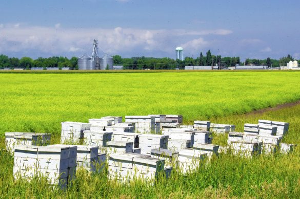
Bee Location Tracking
ATS is very concerned about SAFETY on all aspects of farming. We have all had issues on the locations of Bee Boxes especially when lining up pesticide applications. ATS developed a Bee tracking module that allows bee keepers, applicators and ALL Farm Team Members to...
Chemical Lockup, Fertilizer Tank, & Acid Tank Locations
ATS can mark and send locations to smart devices in order to help expedite and take the guesswork out of deliveries. ATS also allows you to print maps and send them via email or text message. You can send these locations through a text message...
Chemical Lockups, Office, Hazard Area, Loading Zone, Fertliizer Drop Points
ATS has several attributes inside the Mapping module. ATS allows to map any location lockup, Hazard area, and loading zones to minimize guessing of where to go and where you need to be. You can also easily add a location point or boundary for your...
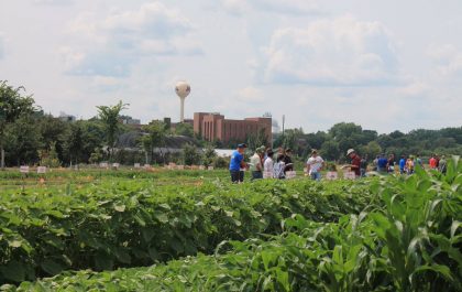
Trinitas Farming
Agri Tracking Systems brings real-time visibility and tracking to Trinitas Farming Agri Tracking Systems (ATS) provides integrated software to help growers plan, map, track, store, analyze, and report on every aspect of the farming operation. Trinitas farms over 20,000 acres of almonds and olives in...
Fine Grained Staff Permissions
ATS know your farm information is valuable and sensitive! This is why we developed a Fine-Grained staff permission feature of the program. ATS has the ability to allow access for certain individuals to access and input data in the system. For example, Irrigators may only...