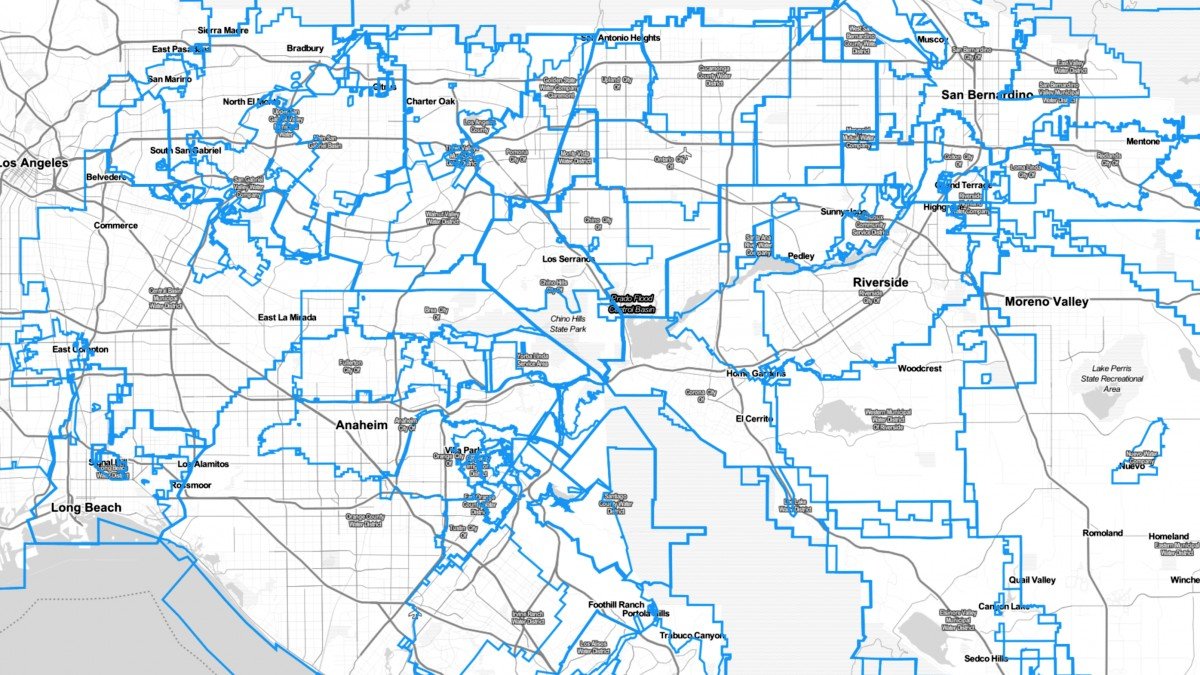
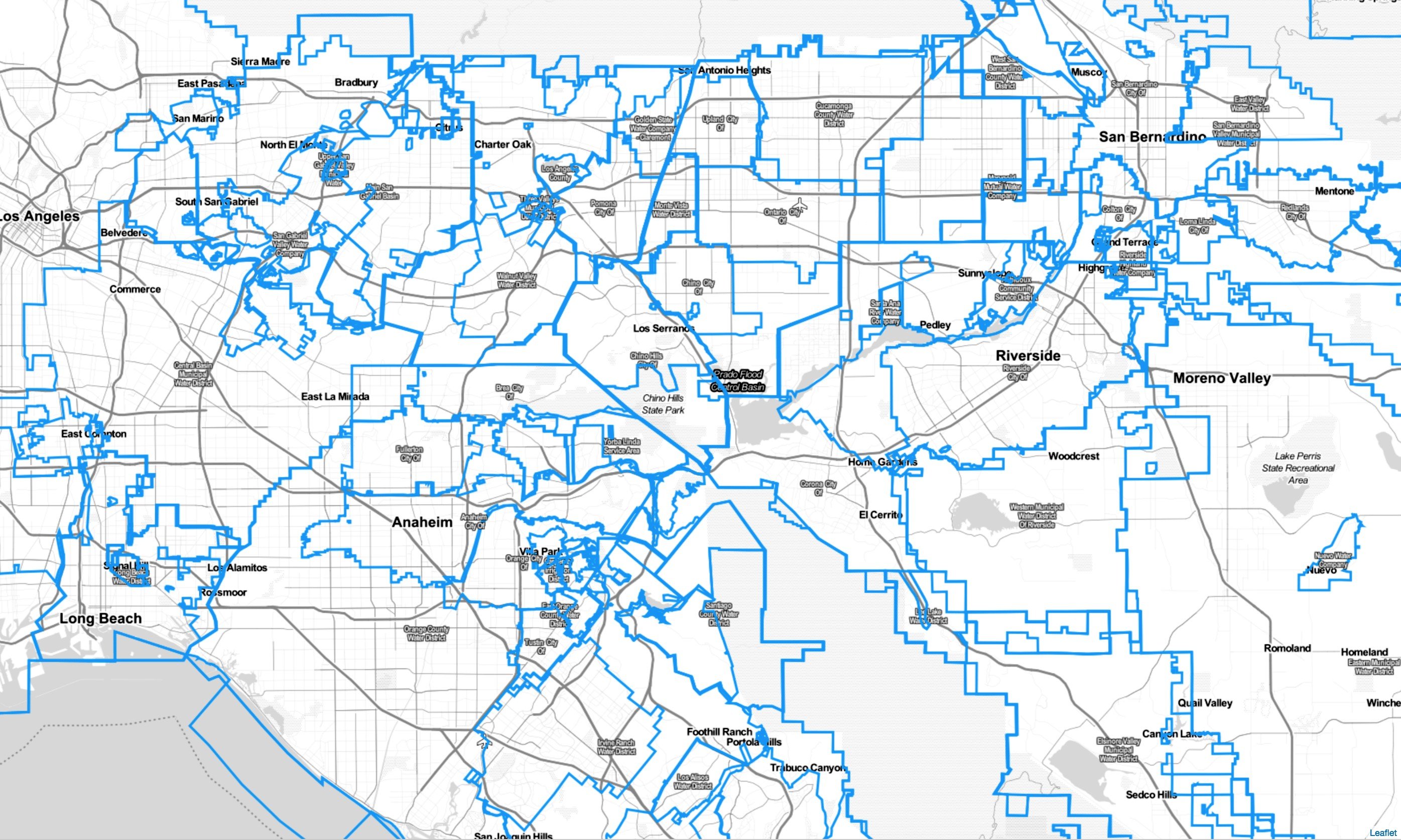
ATS was able to bring in and overlay Water District maps into the mapping module. This helps in identifying what water district you belong to when purchasing new properties or when you are managing multiple properties with multiple owners. Again, anyone in your team has access to this feature.
Trinitas Farming
Agri Tracking Systems brings real-time visibility and tracking to Trinitas Farming Agri Tracking Systems (ATS) provides integrated software to help growers plan, map, track, store, analyze, and report on every aspect of the farming operation. Trinitas farms over 20,000 acres of almonds and olives in...
Fine Grained Staff Permissions
ATS know your farm information is valuable and sensitive! This is why we developed a Fine-Grained staff permission feature of the program. ATS has the ability to allow access for certain individuals to access and input data in the system. For example, Irrigators may only...