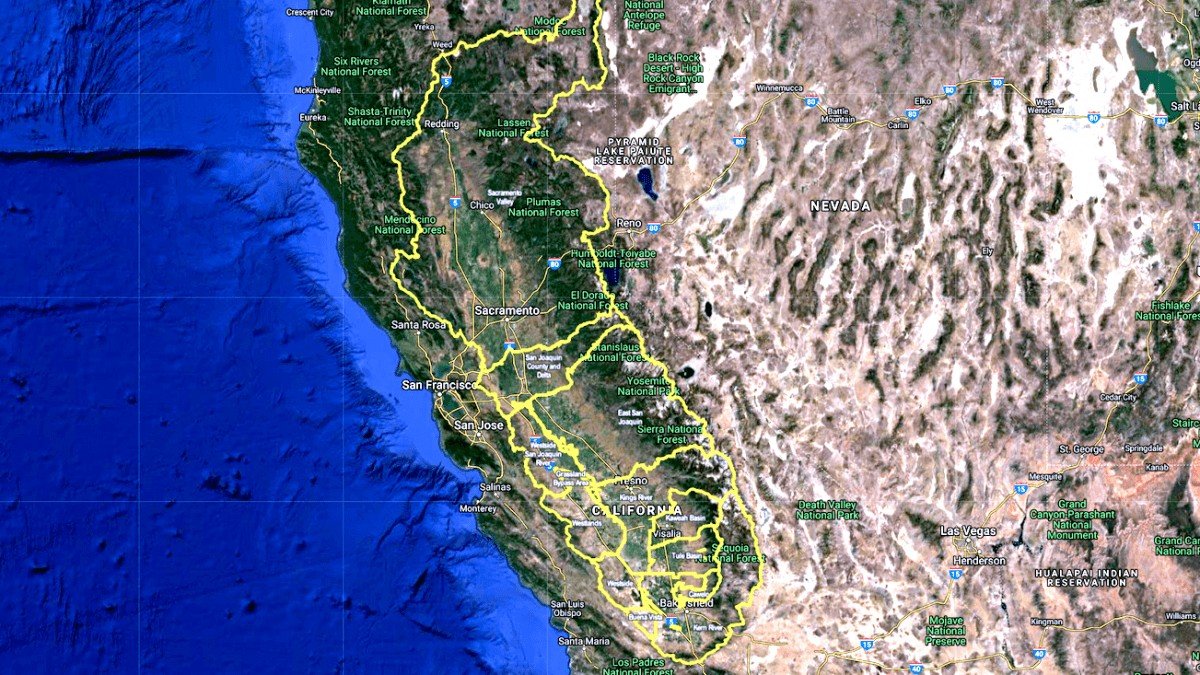
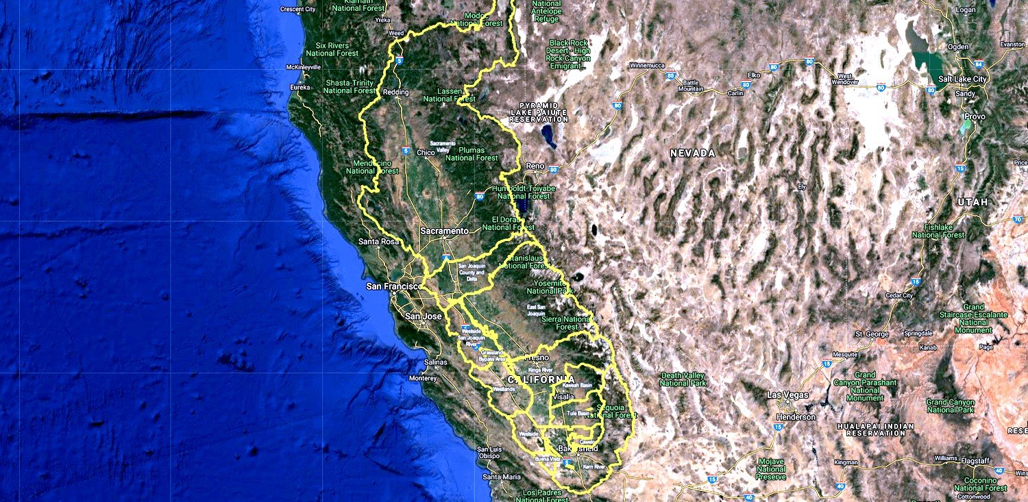
ATS has created an overlay inside its mapping module to show ILRP coalition boundaries. This allows you to know and prove which coalition your field belongs to. ATS has found a few APN’s that were originally thought to be in one coalition but actually in another.
Trinitas Farming
Agri Tracking Systems brings real-time visibility and tracking to Trinitas Farming Agri Tracking Systems (ATS) provides integrated software to help growers plan, map, track, store, analyze, and report on every aspect of the farming operation. Trinitas farms over 20,000 acres of almonds and olives in...
Fine Grained Staff Permissions
ATS know your farm information is valuable and sensitive! This is why we developed a Fine-Grained staff permission feature of the program. ATS has the ability to allow access for certain individuals to access and input data in the system. For example, Irrigators may only...